PosBary
The idea was simple : finding the best point in a map for n peoples to meet, called the barycenter there. I first made the mean of the sum of latitudes and longitudes, but that was obviously not the good solution (the distance between 2 longitudes depends on the latitude,…). So later I used the Great Circle distance (I could use the Vincenty’s formula but that’s a little bit overkill).
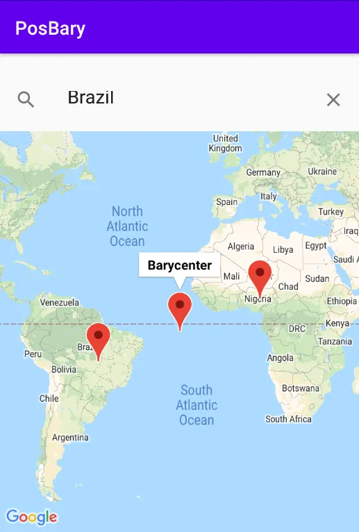
Android App
The mean of the sum of latitudes and longitudes that was enough to use as test for the distance in a small app, so I discovered the google map api platform and usage of the Maps in Android.
New way to calculate the Barycenter
I developped a technique that throw a lot of points in the map, check the best found and then throw a list of point in a smaller area around it (kinda like a genetic algorithm, but only the best of each generation is kept (if the “cost” have only one local minimum and is continuous that’s not a problem) and the mutations reduce over time).
That find the point with the smallest value for the equation of the distance to all the input points.
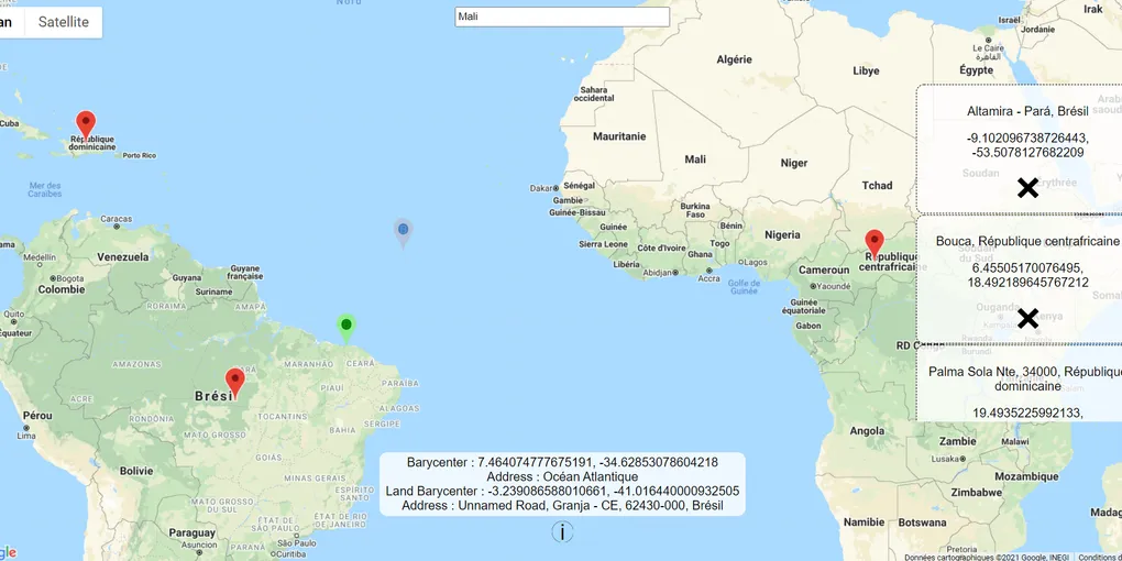
Another goal was added, the point should be in the lands.
I had some difficulties to make a 3 color gradient, having fun results :


But I finally managed to get the program working and made with a little editing to add the map this graphic :
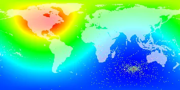
- From blue to red the cost increasing
- In green to dark purple the points that search the barycenter in a smaller area at each operation
- In pink the points in lands searched in an area increasing from the barycenter previously found
(The purple point is the barycenter found by the method, validated by the cost map where blue is low cost and red high cost)
Website
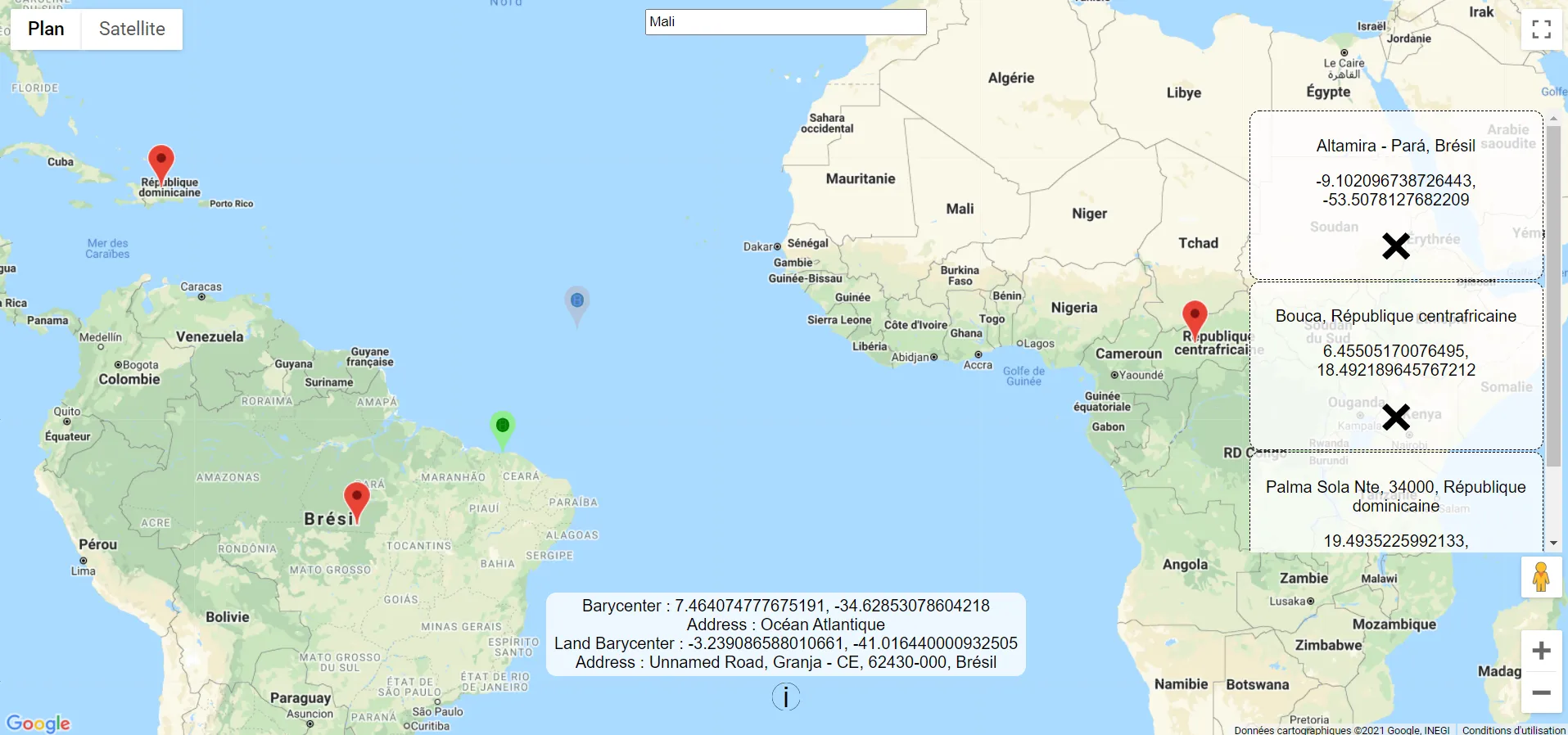
To target more devices I also decided to switch to a Website.
Improvements
- Add a way to import locations from a file (csv, gpx, kml, …)
- Finding the “Travel Barycenter”, the destination that make all people use the less time in car transport to meet, using distance matrix apis (Actually working, but improvements are needed to reduce and optimize api calls, and to show all the routes and the times on the map too)
- Fine tune the algorithm
- Use OpenLayers to avoid usage of proprietary google APIs
- Make travels easily sharable and time aware